:quality(70)/cloudfront-us-east-1.images.arcpublishing.com/cmg/WW5AJL3ARQUGDQMAQUNSFX4CLE.jpg)
Jacksonville, Fl. — The “Buresh Bottom Line”: Always be prepared!.....First Alert Hurricane Survival Guide... City of Jacksonville Preparedness Guide... Georgia Hurricane Guide.
STAY INFORMED: Get the * FREE * First Alert Weather app
FREE NEWS UPDATES, ALERTS: Action News Jax app for Apple | For Android
WATCH “Talking & Tracking the Tropics: The Science Behind the Season”
WATCH “Preparing for the Storm”
READ the First Alert Hurricane Center “Survival Guide”
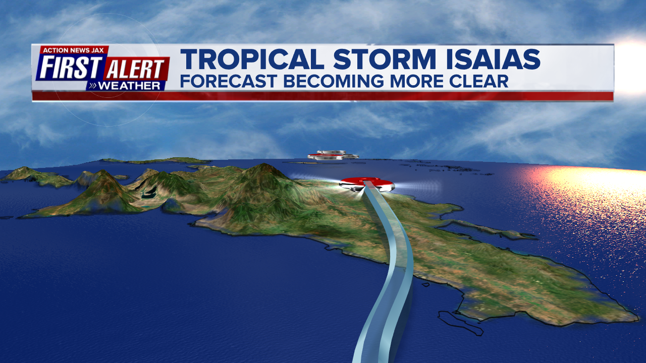
*** Low pressure/tropical wave ’92-L’/‘Potential Cyclone Nine’ was upgraded to tropical storm Isaias Wed. evening while over the Eastern Caribbean - still unclear exactly how this scenario will unfold but some impacts to Fl. are possible over the weekend into early next week - stay up to date. Isaias is the 5th July named storm over the Atlantic which ties the record for the month set in 2005. It marks the fastest to ‘I’ beating the previous record set by “Irene” in - when else - 2005.
LOCAL JACKSONVILLE/NE Fl./SE Ga.:
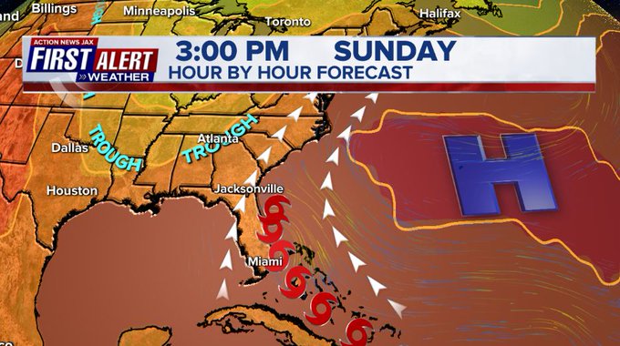
Indications are that Isaias will now steadily strengthen while moving northwest then more northward potentially staying east of Florida with a track anywhere from 80 - 130 miles - at least - east of NE Fl./SE Ga. with closest approach Sunday afternoon into Sun. night. On this track, impacts locally for Jax/NE Fl./SE Ga - subject to change!:
-- bands of heavy rain north & northwest of the center Sunday/Sunday night. Amounts ranging from 1-2″, locally more near the coast to a half inch or less west of I-95
-- a dangerous rip current risk at area beaches with rough seas & surf. The best advice is to stay out of the ocean over the weekend... ships & boats should stay in port.
-- an isolated waterspout or two Sunday.
-- breezy winds of 15-25 mph, gusts 30+ mph at the beaches... 10-20 mph along I-95... much lighter inland west of I-95
-- overall - as long as the forecast track is accurate - impacts to NE Fl./SE Ga. should be relatively minor & most significant at area beaches.
Isaias remained quite well organized while traversing the rugged terrain of the Dominican Republic missing some of the highest mountainous peaks.
The somewhat loosely organized center will likely jump around some until it can become consistently couched under the stronger convection. Isaias should slow as it nears the edge of the upper level ridge through Fri. while intensifying into a hurricane.
Forecast models have generally started to converge on a solution that takes Isaias to the SW Atlantic & Bahamas then a little east of Fl. to very near the Carolina’s late Monday. The expectation is for environmental conditions do be favorable enough for Isaias to become a hurricane.
Overall forecast models recently have generally trended north & east & still insist on the northward move which is more realistic now that there is a center & the system - as a whole - is “deeper”, better organized. There is a good deal of shear (8th image below) in the vicinity of Isaias - on the order of 25-30+ mph - but the shear decreases the more north & west it goes (until shear increases some closer to Florida due to an approaching upper level trough). There is also some dry air (7th image below) that may occasionally infiltrate the system.
There is an alleyway of sorts developing near the U.S. east coast/far W. Atlantic. A more organized Isaias seems to now be sniffing out that alley lending confidence to the more north & east solution in the long run. The approaching upper level trough moving into the Eastern U.S. should help eventually steer Isaias north then northeast. The trough may help with the upper level ventilation of the storm negating some of the effects of potential low level shear while along or near the east coast & Isaias may undergo a period of fairly “solid” intensification through the weekend/early next week as indicated by some models..... &, therefore, be even stronger - at times - than a Cat. 1 hurricane.


Current shear:

Dry air:

As for rainfall... the European is heaviest since the operational run is more west. The GFS model is far less given its forecast track to the east.


Tropical waves continue to move west off Africa but conditions are not particularly favorable for development at the moment but will need to be monitored, of course.

E. Atlantic tropical wave/disturbance spaghetti plots:

A strong tropical wave is just off the coast of Africa. While there is short term potential for some development, long term potential appears limited.


:quality(70)/cloudfront-us-east-1.images.arcpublishing.com/cmg/HJ3L3HBBJBH6PB5ZFB3SVGFXSU.png)
:quality(70)/cloudfront-us-east-1.images.arcpublishing.com/cmg/4TQDXERT5VGORNZ4NQWXNO5H64.png)
:quality(70)/cloudfront-us-east-1.images.arcpublishing.com/cmg/SKX4RKW645ERTATCLA4V2FVRKQ.png)
:quality(70)/cloudfront-us-east-1.images.arcpublishing.com/cmg/5PIZRG7NYBAHDDABTG5BNVGO6Y.jpg)
:quality(70)/cloudfront-us-east-1.images.arcpublishing.com/cmg/V7JDMMD6JJEEHIL6C7OSLV3ABU.png)
:quality(70)/cloudfront-us-east-1.images.arcpublishing.com/cmg/DLSODS2FQDFAGYTWAB2BNIA4FE.jpg)
:quality(70)/cloudfront-us-east-1.images.arcpublishing.com/cmg/VH7BQKFH72ZQ7FAA6EUDFVJNAA.jpg)
:quality(70)/cloudfront-us-east-1.images.arcpublishing.com/cmg/P5CIWEAXS4QEMMD3HCOFIX6NUM.jpg)
 Sign Up

