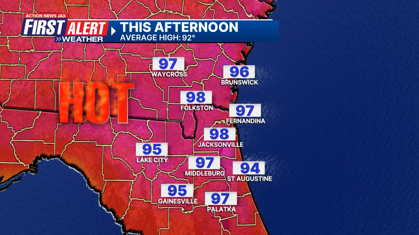
JACKSONVILLE, Fla. — Yesterday was the third day in a row at or above 100 degrees in Jacksonville. We topped out at 101 in Jacksonville at JIA for the second day in a row.
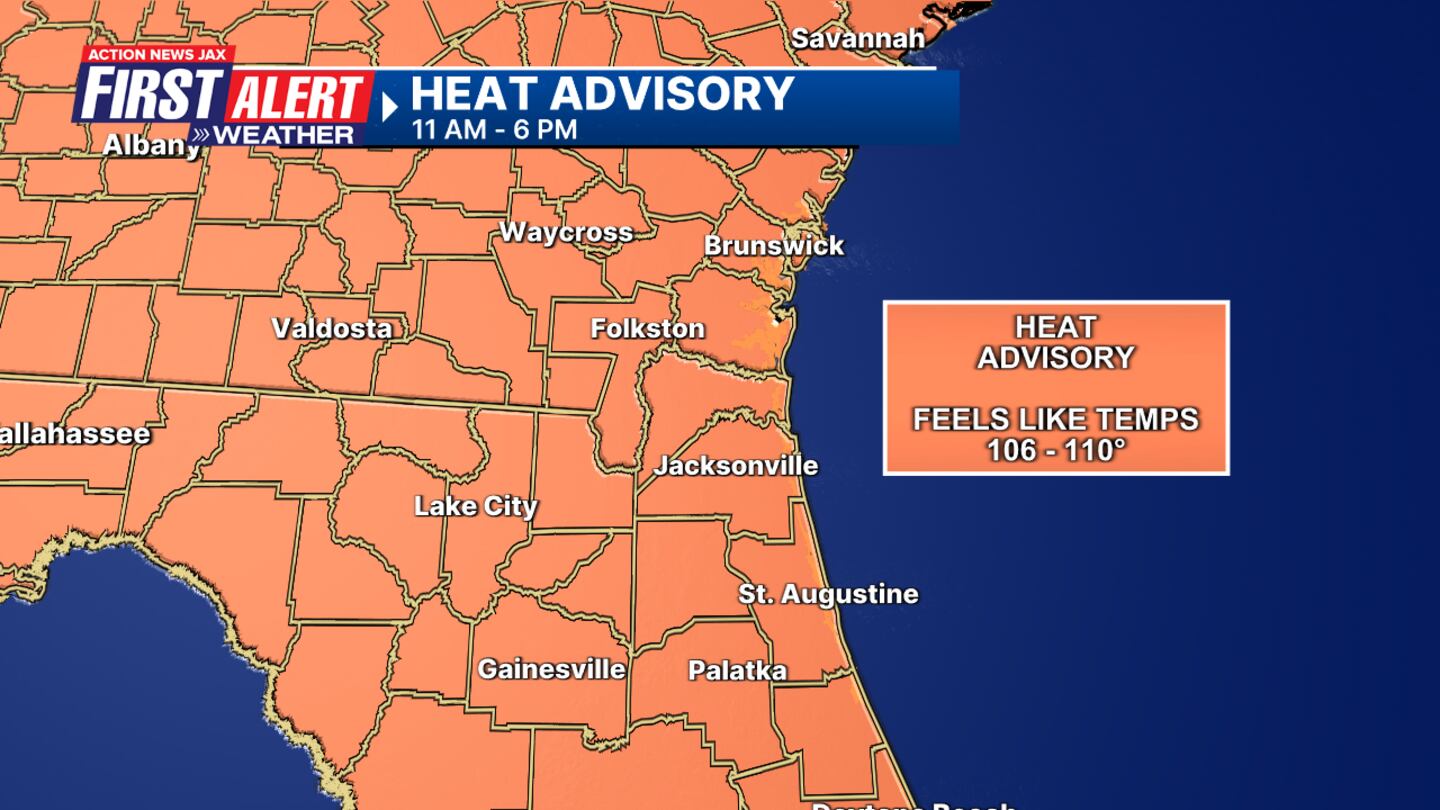
- Oppressive heat: Feels like temperatures will be 106-110 this afternoon.
- A heat advisory will take effect for all of NE Florida and SE Georgia at 11 a.m. to 6 p.m.
- A few showers and storms will begin to develop after 2 p.m.
- Locally heavy rainfall and lightning strikes are likely.
- Highs tomorrow will still be hot in the upper 90s.
- This weekend presents a decent shot at more widespread rain and storms.
- Highs stay in the mid to upper 90s through the first half of the weekend.
TROPICS:
- No areas of immediate concern. Some long-range potential late next week and the following week over or near the Caribbean and/or SW Atlantic.
- Always more: “Talking the Tropics With Mike”.
TODAY: Partly sunny and hot with a few afternoon storms. HIGH: 98. Feels like: 106-110
TONIGHT: Warm. LOW: 76
THURSDAY: Partly sunny, isolated storms. 76/98
FRIDAY: Partly sunny, isolated storms. 76/97
SATURDAY: Partly sunny, scattered afternoon showers and storms. 76/95
SUNDAY: Partly cloudy, scattered showers and storms. 75/90
MONDAY: Partly cloudy, scattered showers and storms. 74/92
TUESDAY: Partly cloudy, scattered showers and storms. 73/92
>>> STREAM ACTION NEWS JAX LIVE <<<
[DOWNLOAD: Free Action News Jax app for alerts as news breaks]
[SIGN UP: Action News Jax Daily Headlines Newsletter]
Click here to download the free Action News Jax news and weather apps, click here to download the Action News Jax Now app for your smart TV and click here to stream Action News Jax live.


