
A stalled front has degenerated into a weak trough from the Northern Gulf to N. Florida to the SW Atlantic with only disorganized largely diurnal convection - no low pressure &/or tropical development expected.

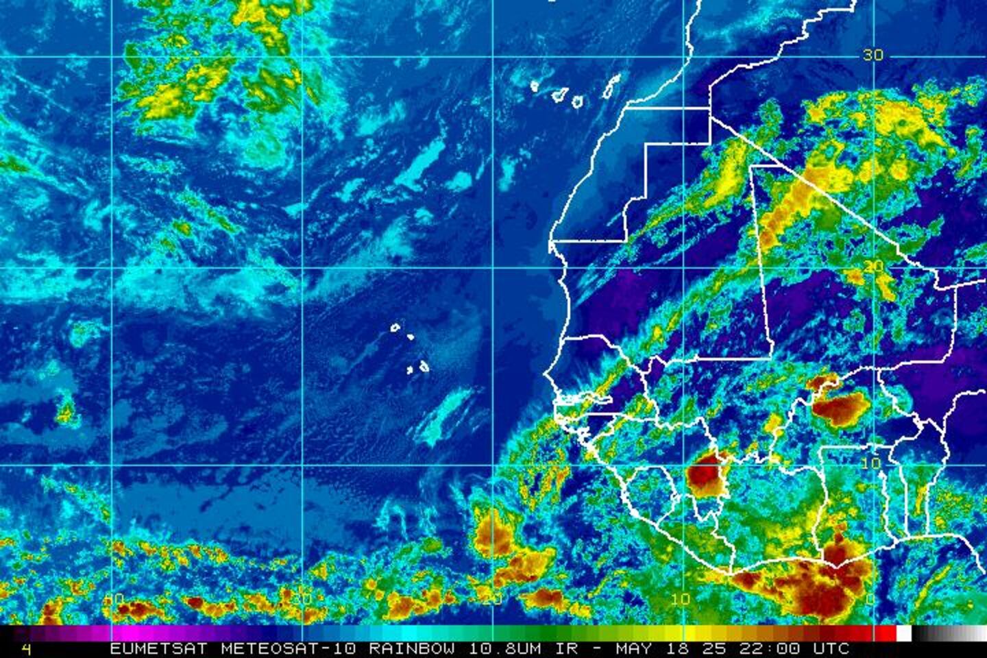
Water vapor imagery shows tropical moisture well entrenced across Jax & nearby areas:

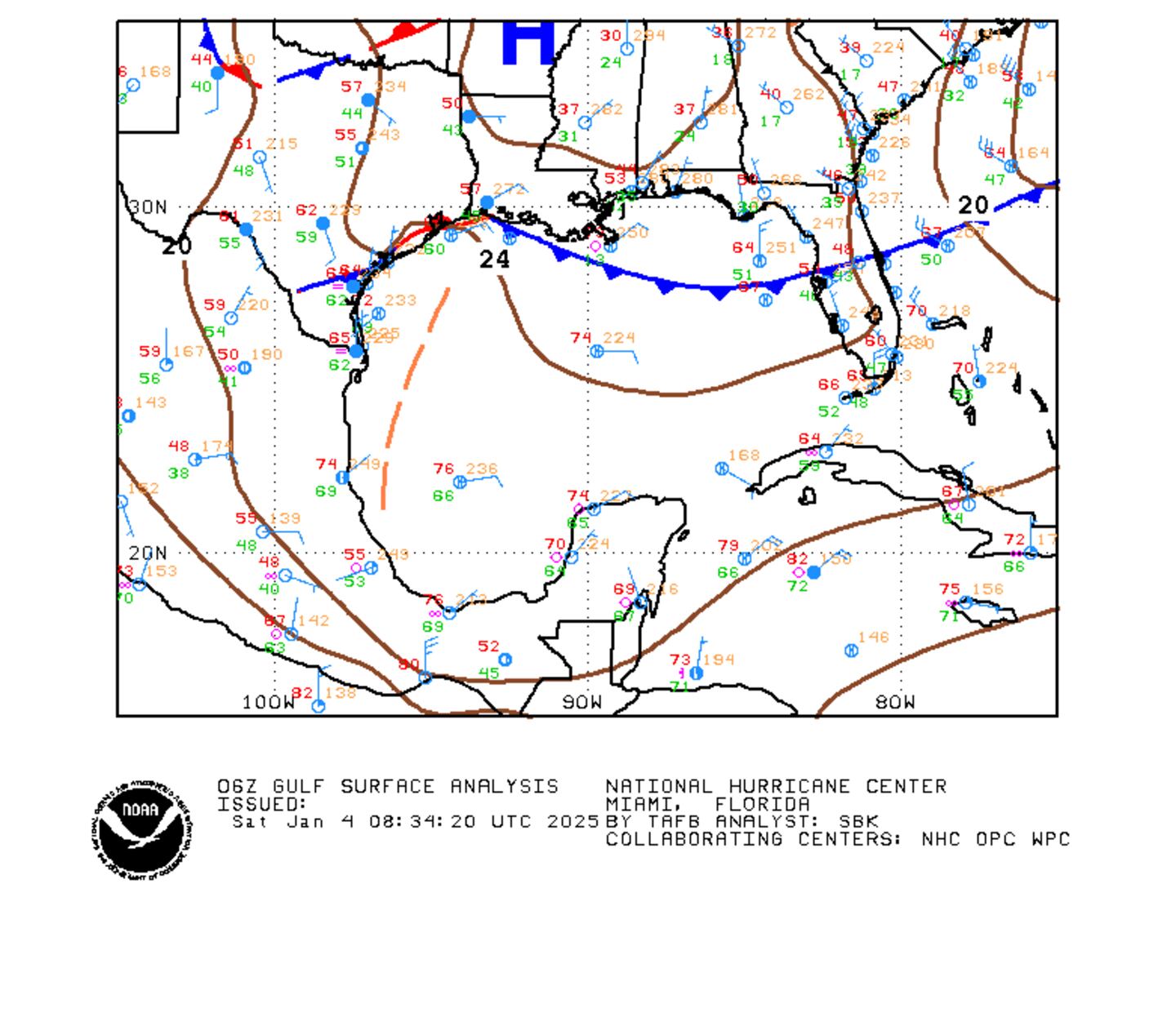
Surface analysis of the Gulf:
Caribbean:
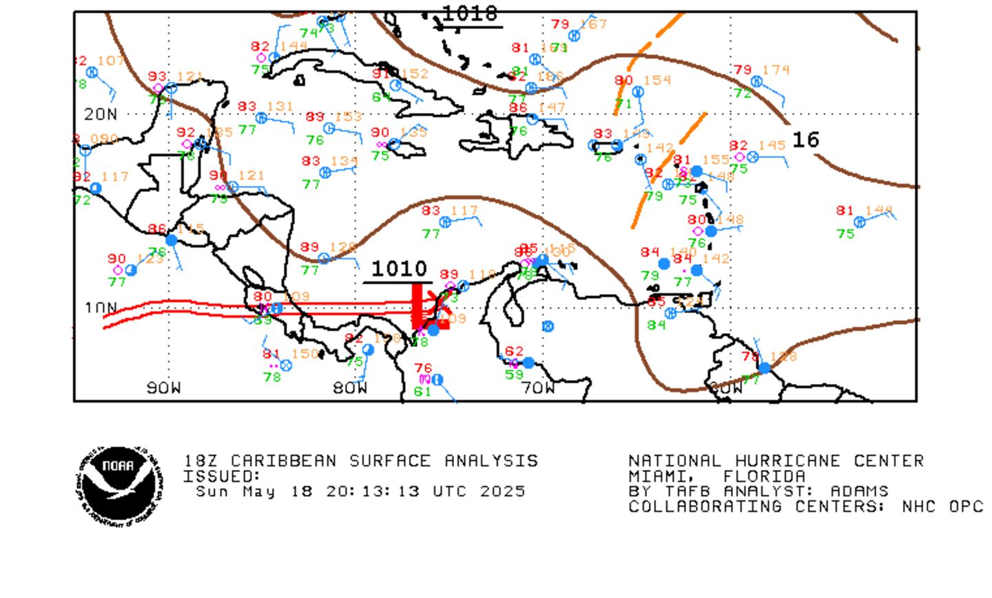
A weak tropical wave is approaching the SE Caribbean - no development expected.

There continues to be an unseasonably early strong "wave train" parading off the coast of Africa, & we might see an attempt at tropical development from one of these waves between approximately the 5th & 15th of July....
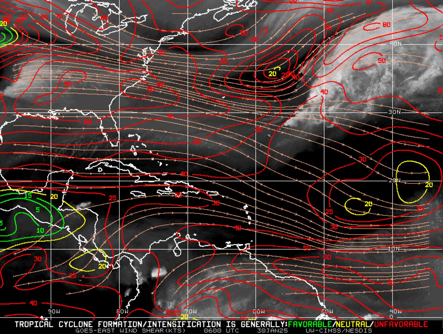
Wind shear analysis:
We're putting June in the history books, & it was a relatively active first month of the hurricane season. By "law of averages", June should only have a named storm every other year but two -- "Bret" & "Cindy" developed this year. Even more unusual is that "Bret" was born from an African tropical wave at about midway across the Atlantic - well before the typical "African wave" season. In fact, there have only been 2 tropical cyclones at the same time in June in 3 other years - 1909, 1959 & 1968. Interestingly.... the last few years have had active June's including 3 last year & 2 each in 2012 & 2013.
So for June, 2017.... "Bret" had only a 24 hour lifespan as it skirted the coast of Venezuela on its way into the Caribbean dropping flooding rains on Trinidad. "Cindy" developed over the Gulf of Mexico & moved northwest making landfall near the La./Tx border bringing flooding & isolated tornadoes to much of the Gulf coast.
Maps below by Jasper Deng - Created by Jasper Deng using WikiProject Tropical cyclones/Tracks. The background image is from NASA. Tracking data is from NHC.


