
JACKSONVILLE, Fla. — The “Buresh Blog” will take some time off with the next new post the week of Aug. 24th.... *but* ...
The 2026 hurricane season continues... see & read updates every day at “Talking the Tropics With Mike”.
To become a part of the First Alert Neighborhood weather station network powered by Tempest - scan below &/or click * here *:

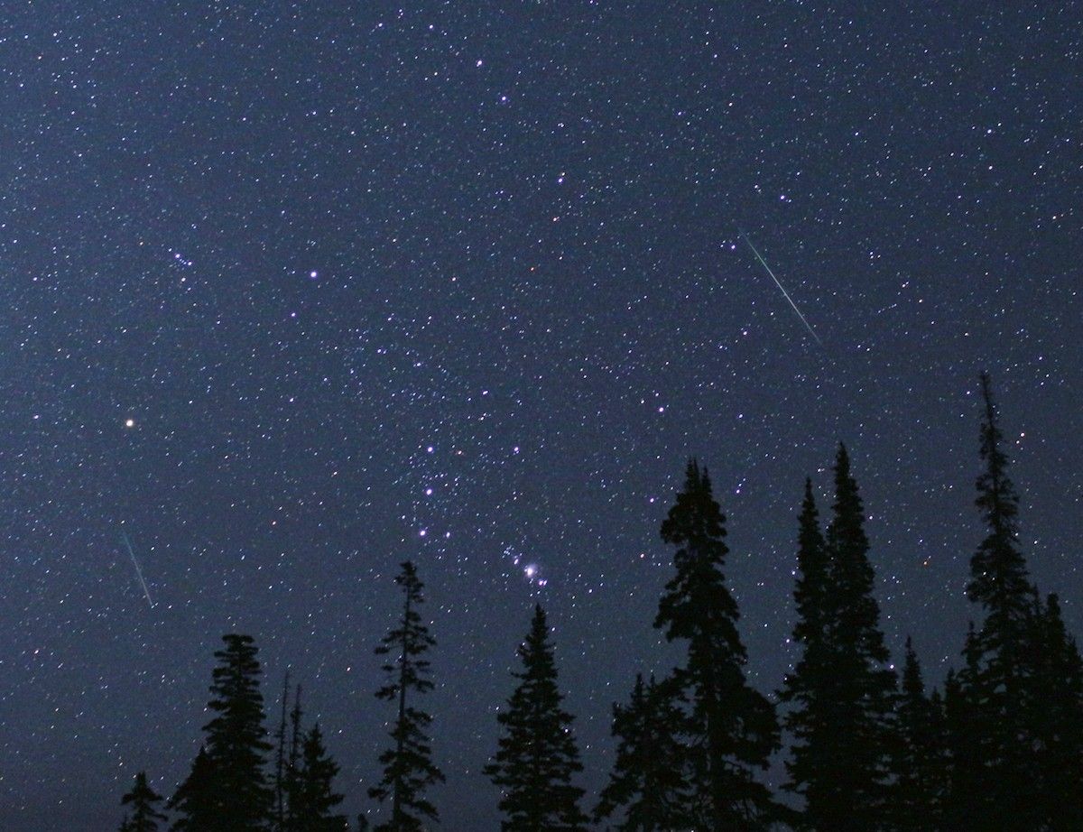
The annual Perseid meteor shower peaks Wed.-Thu. Aug. 12-13. The new moon phase will help & there should be enough breaks in the clouds over NE Fl./SE Ga. to get a view. Make sure to get away from light pollution with the “prime time” from about midnight to 5:30am. And the Perseid’s only slowly fade so viewing will be possible past the peak... through about Aug. 24.

Photo - NASA/Bill Dunford:
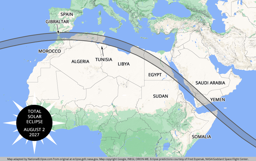
Aug. 12 is a full solar eclipse *but* not visible from Jacksonville or any of the U.S.
Map from NationaEclipse.com:

And once again a group of students from UNF led by fearless & talented professors Dr. Nirmal Patel & Dr. Hemani Kaushal were chosen - & funded - by NASA to launch a high altitude balloon to measure changes in atmospheric conditions, including temperature, humidity, pressure, dew point and ozone concentration. The instruments will also gather data on energetic particles, radiation levels, radio communications and capture images of the moon’s shadow moving across Earth during totality. I spoke with the group a few days before their flight overseas:
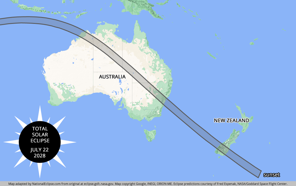
And Dr. Patel has his eye (not literally!) on the full solar eclipse next year - again over Spain - as well as in 2028 over Australia & New Zealand.
Maps from NationalEclipse.com:
Personally - I’m counting down to the next “Great American” eclipse on Aug. 12, 2045 :)


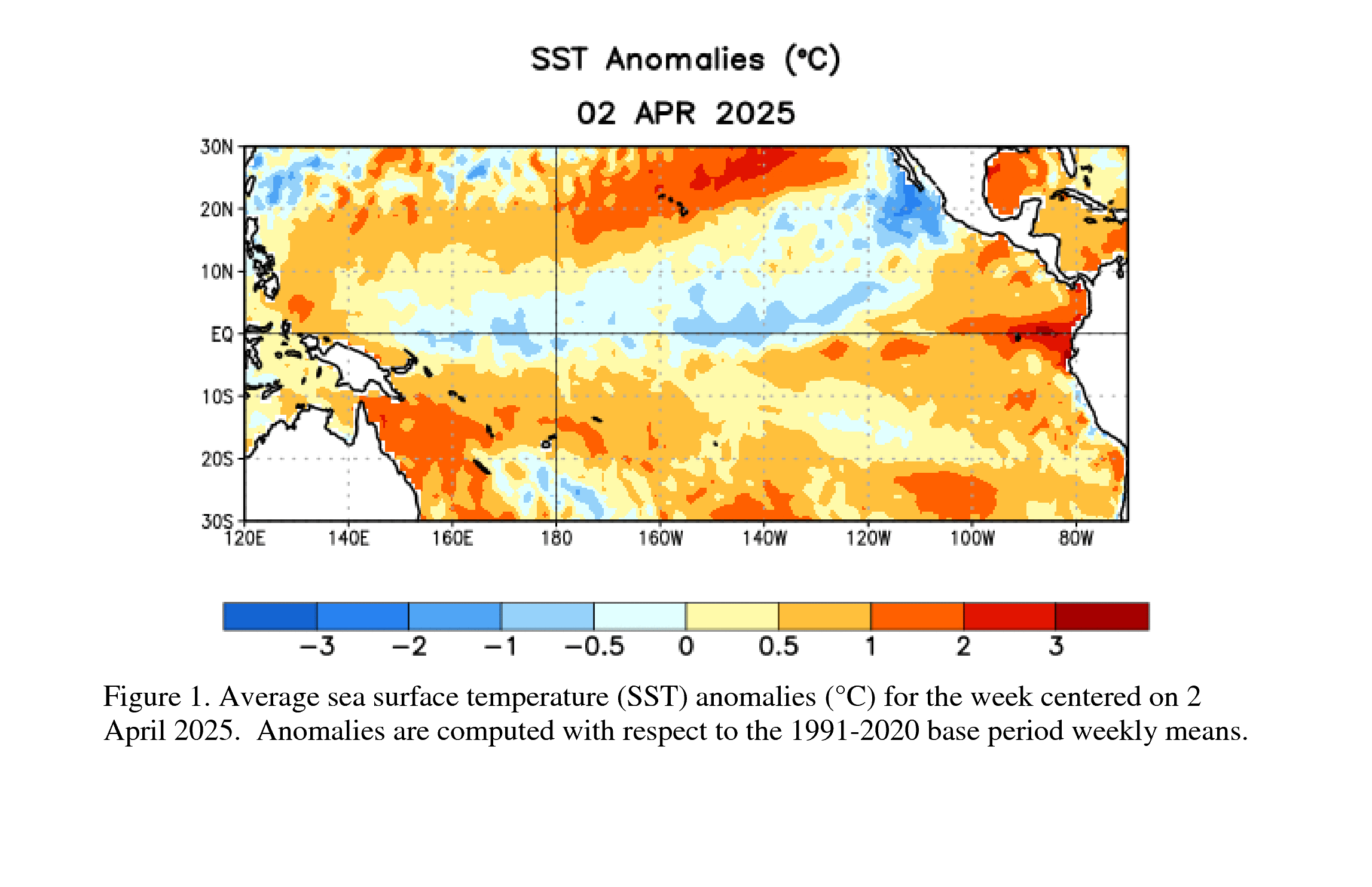
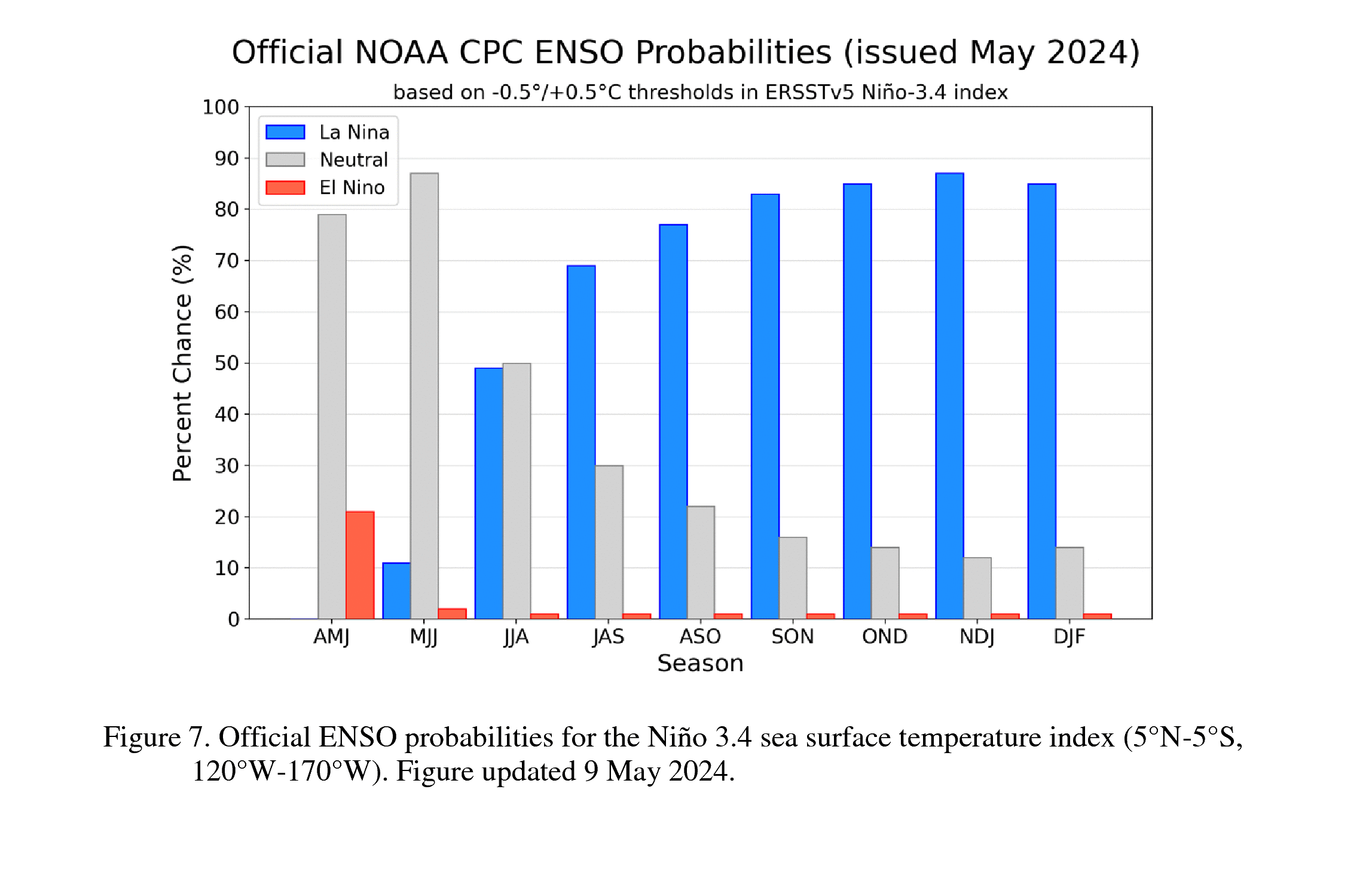
I’ve been talking a lot about - & updating - the El Nino since last winter & spring... & in NOAA’s latest update, they are all onboard for a major El Nino possibly of record proportions. The warming of the equatorial Pacific already matches - early in the “game” - some of the strong El Nino’s on record, & it has not even reached its peak. In NOAA’s latest update:
“During the October-December 2026 season, there is a 69% chance of a historic event that would exceed the strength of previous El Niño events dating back to 1950. El Niño is strengthening, with a greater than 90% chance of a very strong event during the Northern Hemisphere fall and winter 2026-27.”
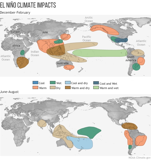
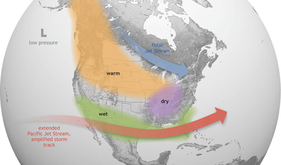
Why it matters (these impacts are not guaranteed & can vary, especially given the overall very warm profile of the earth’s oceans right now) [global impacts * here *]:
- A lower number of tropical cyclones for the Atlantic Basin due to persistent strong wind shear. It’s very important to note it does not mean there can’t be a major storm/hurricane somewhere at sometime. It simply means a lower than average number of tropical storms & hurricanes for the season (through Nov. 30).
- A potentially very wet (& stormy) winter from California to Florida
- Significant challenges for marine life - including major coral bleaching - due to atypical water temps.
NOAA images:

Tropics impacts:

Winter pattern:
Worldwide impacts: