MONROE, Wash. — A blast of arctic air is plunging south from Canada and spreading into parts of the northern U.S., while residents of the Pacific Northwest brace for possible mudslides and levee failures from floodwaters that are expected to be slow to recede.
The catastrophic flooding has forced thousands of people to evacuate, including Eddie Wicks and his wife, who live amid sunflowers and Christmas trees on a Washington state farm next to the Snoqualmie River. As they moved their two donkeys to higher ground and their eight goats to their outdoor kitchen, the water began to rise much quicker than anything they had experienced before.
As the water engulfed their home Thursday afternoon, deputies from the King County Sheriff's Office marine rescue dive unit were able to rescue them and their dog, taking them on a boat the half-mile (800 meters) across their field, which had been transformed into a lake. The rescue was captured on video.
Big cities like Chicago, Minneapolis brace for Arctic air
As the Pacific Northwest begins to recover from the deluge, a separate weather system is already bringing dangerous wind-chill values — the combination of cold air temperatures and wind — to parts of the Upper Midwest.
Shortly before noon Saturday, it was minus 12 degrees Fahrenheit (minus 24 degrees Celsius) in Grand Forks, North Dakota, where the wind chill value meant that it felt like minus 33 F (minus 36 C), the National Weather Service said.
For big cities like Minneapolis and Chicago, the coldest temperatures were expected late Saturday night into Sunday morning. In the Minneapolis area, low temperatures were expected to drop to around minus 15 F (minus 26 C), by early Sunday morning. Lows in the Chicago area are projected to be around 1 F(minus 17 C) by early Sunday, the weather service said.
The Arctic air mass was expected to continue pushing south and east over the weekend, expanding into Southern states by Sunday.
The National Weather Service on Saturday issued cold weather advisories that stretched as far south as the Alabama state capital city of Montgomery, where temperatures late Sunday night into Monday morning were expected to plummet to around 22 F (minus 6 C). To the east, lows in Savannah, Georgia, were expected to drop to around 24 F (minus 4 C) during the same time period.
Danger of mudslides, levee failures continues in Pacific Northwest
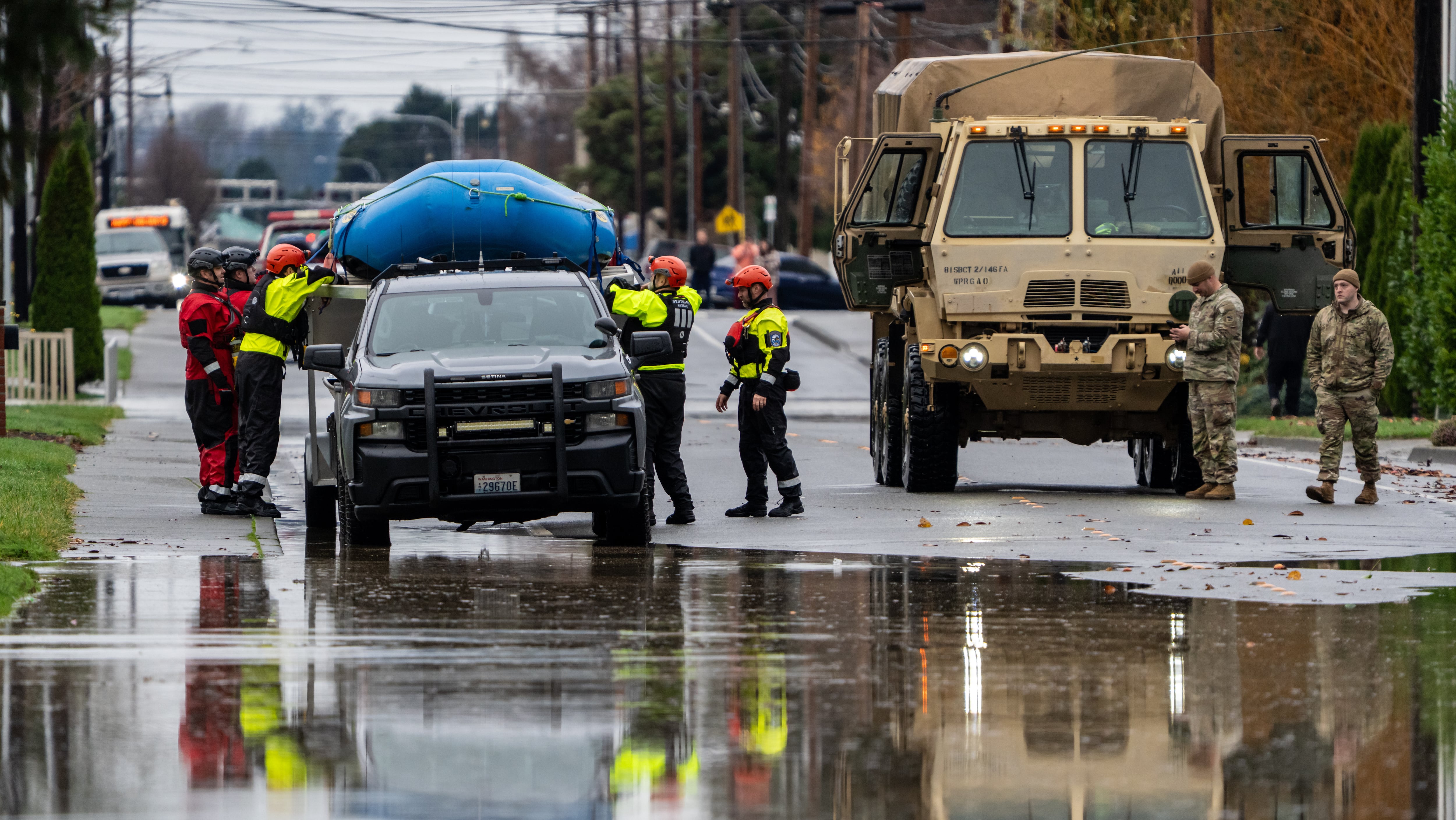
The cold weather freezing much of the country comes as residents in the Pacific Northwest endure more misery after several days of flooding. Thousands of people have been forced to evacuate towns in the region as an unusually strong atmospheric river dumped a foot (30 centimeters) or more of rain in parts of western and central Washington over several days and swelled rivers, inundating communities and prompting dramatic rescues from rooftops and vehicles.
The record floodwaters were expected to continue to slowly recede Saturday, but authorities warn that waters will remain high for days, and that there is still danger from potential levee failures or mudslides. There is also the threat of more rain forecast for Sunday. Officials have conducted dozens of water rescues as debris and mudslides have closed highways and raging torrents have washed out roads and bridges.
—-
Associated Press writers Hallie Golden in Seattle and Jeff Martin in Atlanta contributed.
Copyright 2025 The Associated Press. All rights reserved. This material may not be published, broadcast, rewritten or redistributed without permission.


