
The remnants of tropical depression #4 continue to move steadily - but more slowly - west/northwest with occasional bursts of stronger convection. The shear is slowly lessening but quite a bit of dry air remains in the wave's vicinity. We'll have to cafefully monitor this wave as the system approaches the Bahamas through midweek.... & near Florida by about Thu./Fri. There will be heavy rain & gusty breezes in the wave's vicinity with the wave nearing the coast of Central or Southern Fl. Conditions will be at least somewhat more favorable for some organization, but there are no indications - right now -of a comeback for what was once t.d. #4.

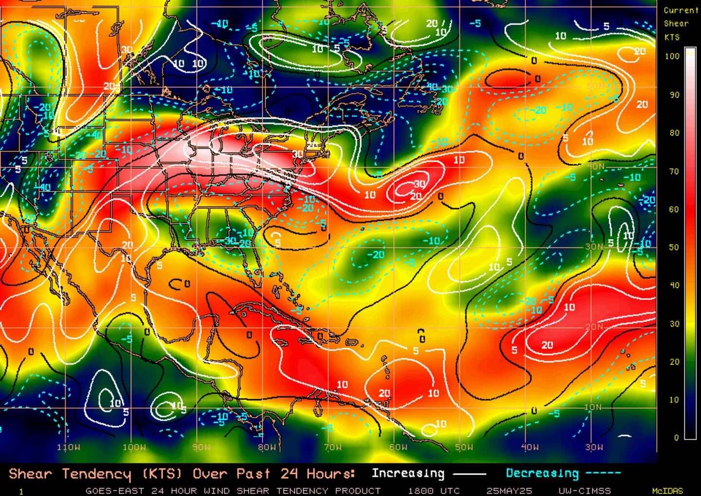
Shear tendency:
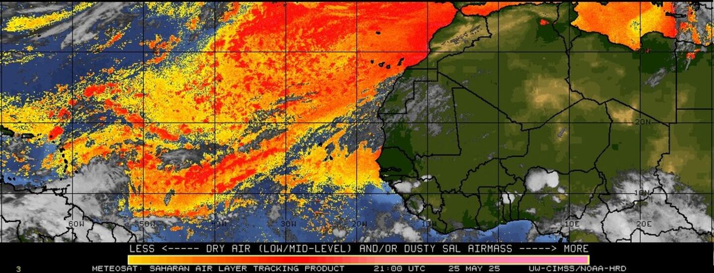
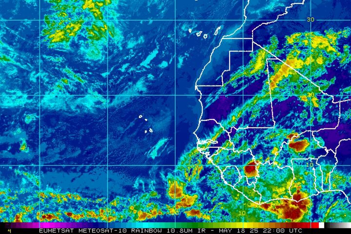
Imagery below courtesy CIMMS shows the continued movement of a tremendous amount of African Saharan dust (orange & red) over the Central & E. Atlantic - an indication of the dry air -- all the way west into the Caribbean.
The Gulf of Mexico... Caribbean & SW Atlantic:

Water vapor imagery:

Surface analysis centered on the tropical Atlantic:

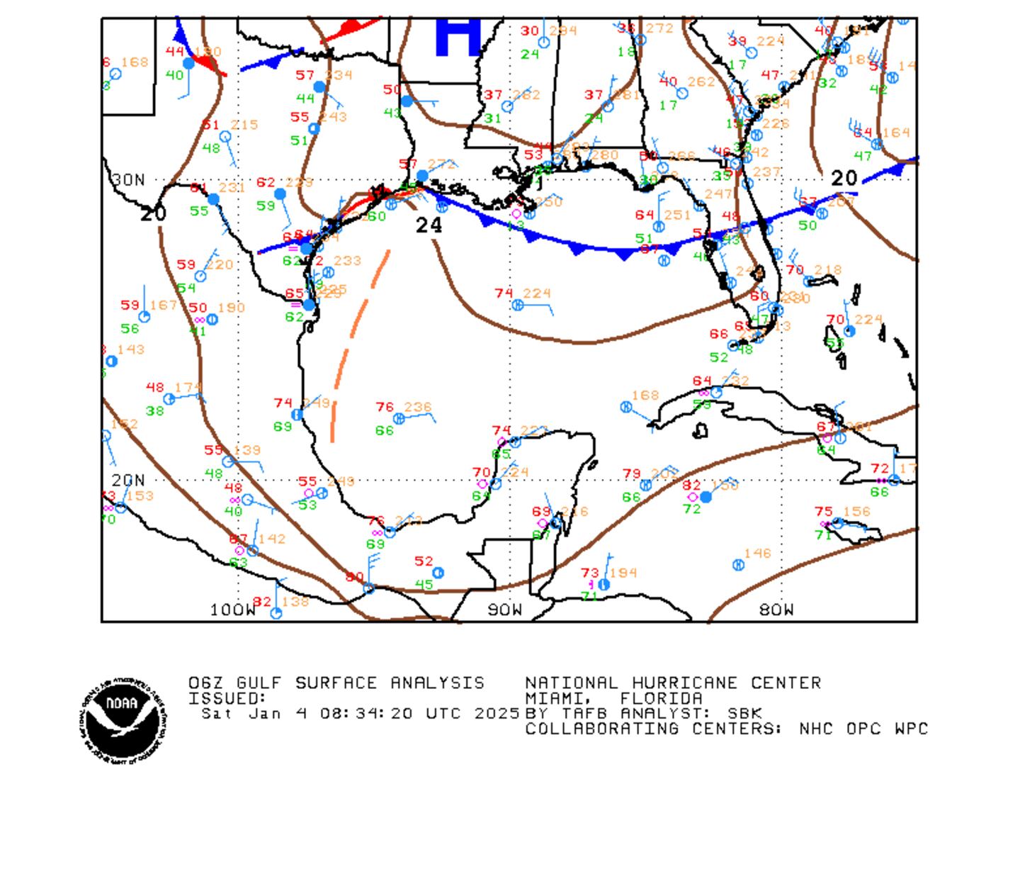
Surface analysis of the Gulf:
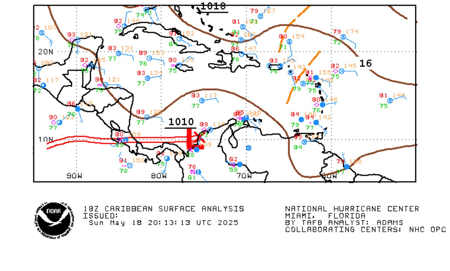
Caribbean:
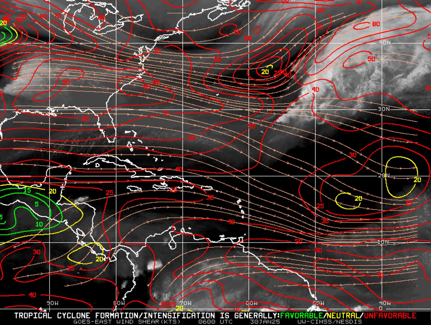
Wind shear analysis - pretty harsh from the Central Atlantic through the Caribbean:
Tropical waves are moving off the coast of Africa. The area is largely being held in check by the large Saharan dust plume alluded to earlier.... & the "popcorn" type cloud cover from 10 to 30 degrees N is indicative of stable air. However, some forecast models are hitting on the development of a tropical cyclone over the next 5-10 days or so possibly originating from a disturbance emerging from the Intertropical Convergence Zone (ITCZ) over the deep tropics then moving west & northwest toward the Caribbean. This development is a long way from a sure thing but something to keep an eye on.
In the E. Pacific.... "Eugene" became a hurricane Sunday well south of the Baja of California & will stay over the open water. Much cooler water temps. will help cause the cyclone to rapidly weaken far to the west of the Baja but rough seas & surf will affect the Baja & even the Southern California beaches.


 Sign Up


