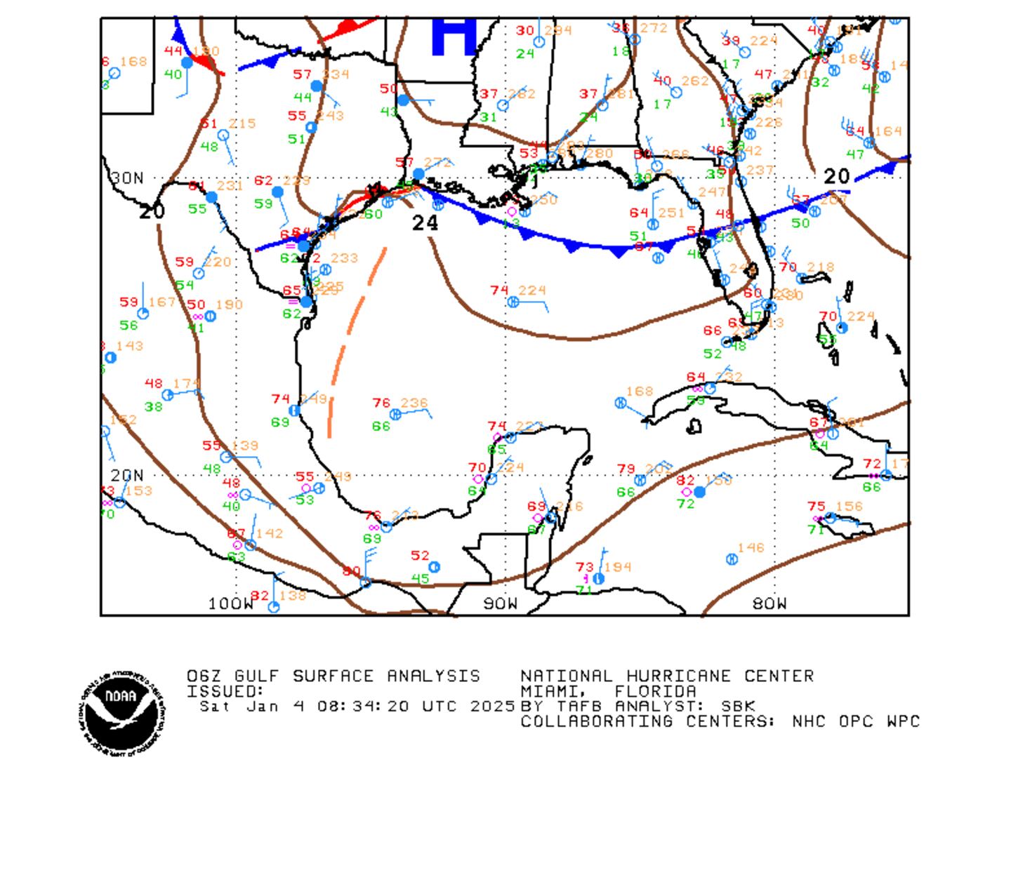
The area of "disturbed weather" -- wave '93L' / potential tropical cyclone #3 -- continues to produce numerous albeit pretty disorganized showers and thunderstorms from the Western Caribbean northward into the Gulf of Mexico. A weak surface low pressure has emerged over the Southern into the Central Gulf . The low pressure is heavily weighted on the right side - in other words, most of the heavy rain, squalls & storms are over the eastern portion of the low pressure area. This slow festering if you will -- with a system tilted to the right -- is pretty classic for early season tropical systems.
The GFS forecast model has trended (thought not as far west) the way of The European & UKMET (a pretty reliable model during last year's hurricane season) showing a track more to the west. It looks like the low will take an alleyway toward Louisiana & Texas - between two strong upper level highs.
The system will not have a major impact on Jacksonville/NE Fl./SE Ga. Heavy tropical-like rains will occur this week with or without a direct tropical storm hit. The heaviest rain will be closer to the low from the Florida Panhandle west to Texas. Tropical storm WATCHES & WARNINGS extend from the upper Texas coastt to SE Louisiana.


Spaghetti plots for the Gulf disturbance:

Gulf of Mexico:

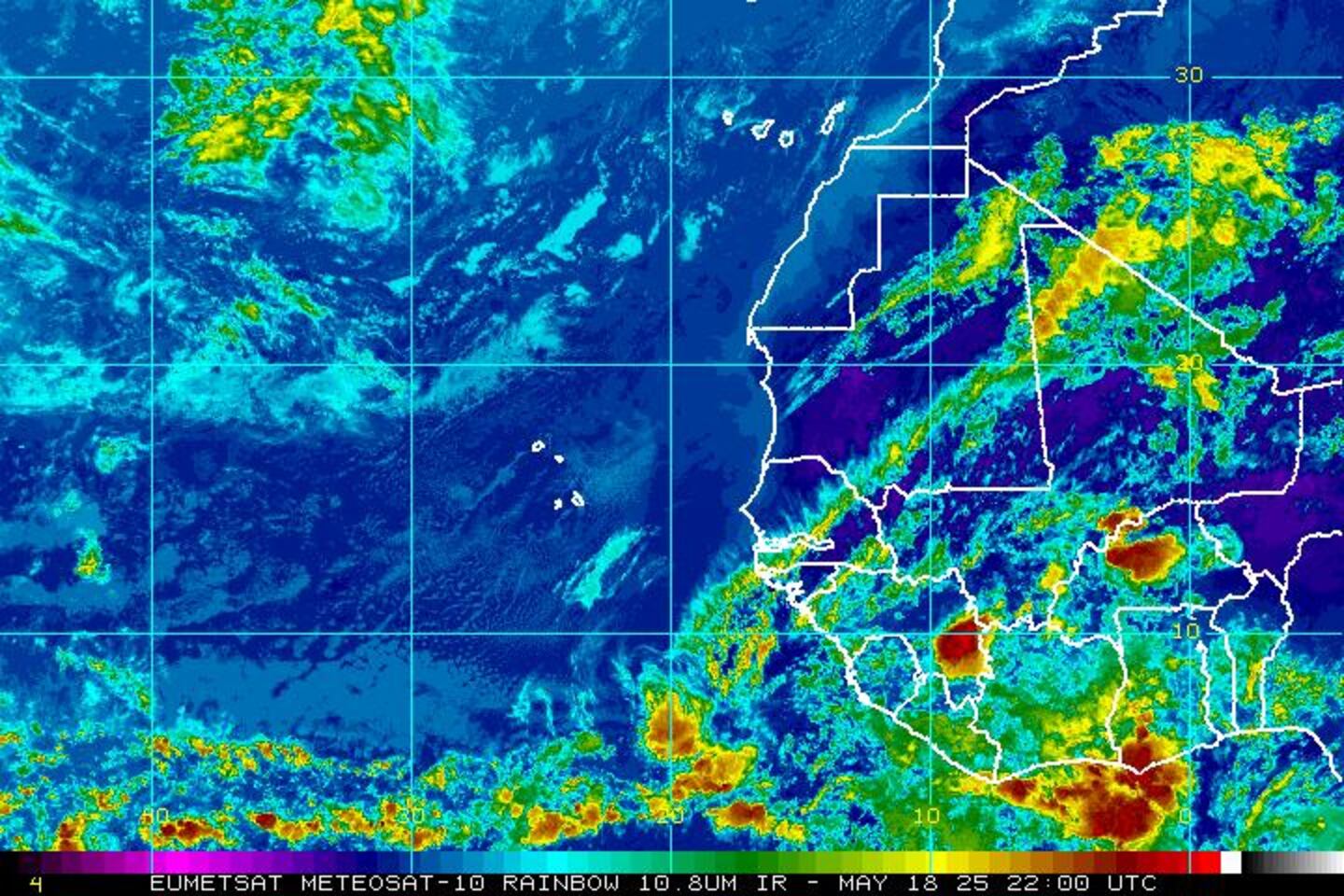
Water vapor imagery below shows the expansive tropical moisture plume from the S.W. Atlantic & Florida extending southwest through the Caribbean & into the Eastern Pacific.

Surface low over the Gulf:
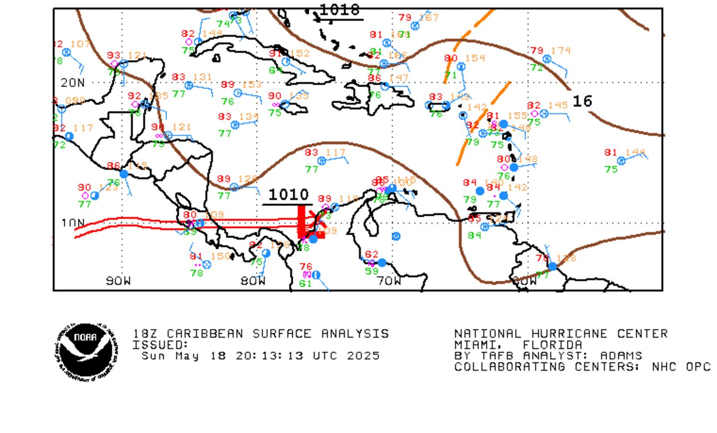
"Bret" in the SE Caribbean:
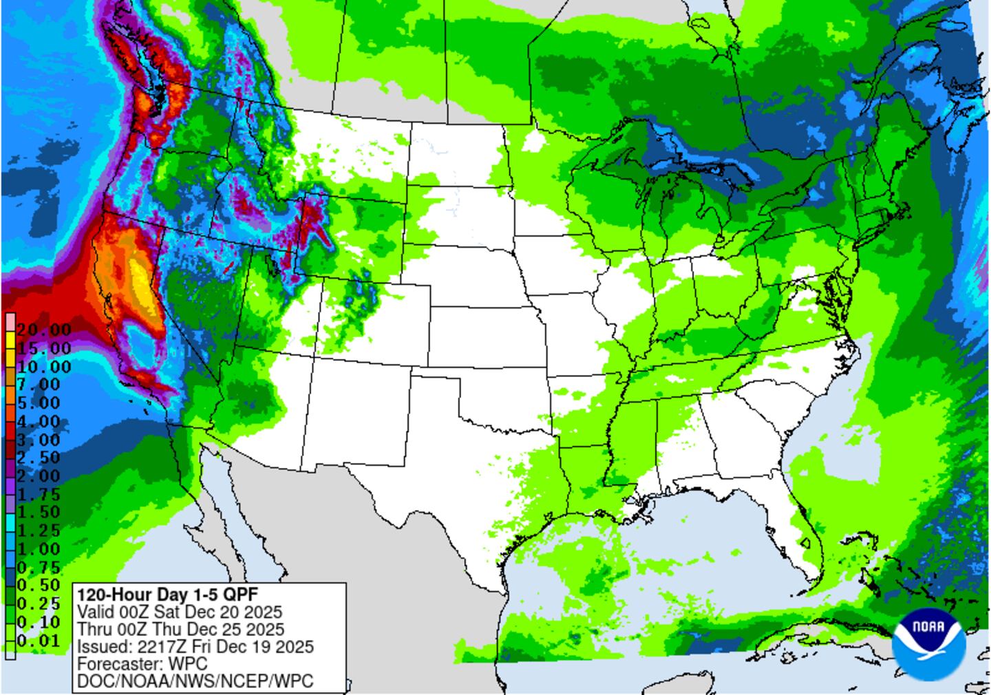
Heavy rain for much of the eastern half of the U.S. this week.... particularly near the Gulf Coast as tropical moisture surges north in association with the Gulf tropical disturbance. Rainfall could exceed a foot near New Orleans.....
Meanwhile.... tropical storm "Bret" was upgraded late Monday. Tropical storm force wind gusts - & possibly sustained winds - will affect the far southern Lesser Antilles as well as the north coast of Venezuela & Aruba. Interaction with land + increasing shear should eventually limit "Bret" which will stay far to the south of Florida so no local impacts.


Spaghetti plots for wave "Bret":

It's awfully early in the season to see an African wave develop into a tropical cyclone such as "Bret" has managed to do. Nothing organized moving off Africa for the moment:
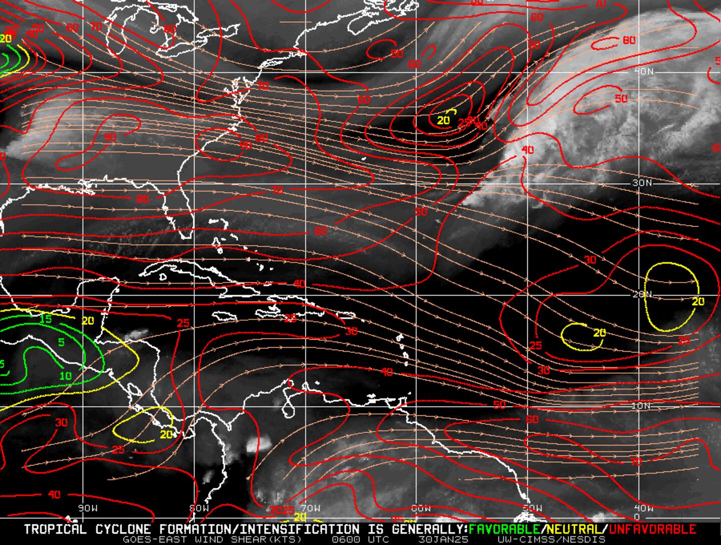
As active as the Atlantic Basin is, an analysis of wind shear shows why organization will be difficult for tropical waves. Shear exceeds 50 knots across much of the Gulf of Mexico, Caribbean & SW Atlantic: