
Jacksonville, FL — We are finally heading into the last week of the very busy 2020 hurricane season. Updates every day: “Talking the Tropics With Mike”.
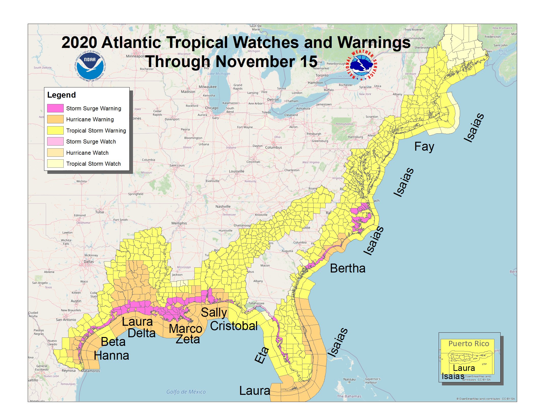
All of the U.S. coastline from Texas to Florida to Maine has - at one time or another - been under some kinds of tropical watch or warning!
And Iota on Nov. 16th made 2020 the 5th straight year with at least one Cat. 5 somewhere over the Atlantic Basin (The Washington Post image):

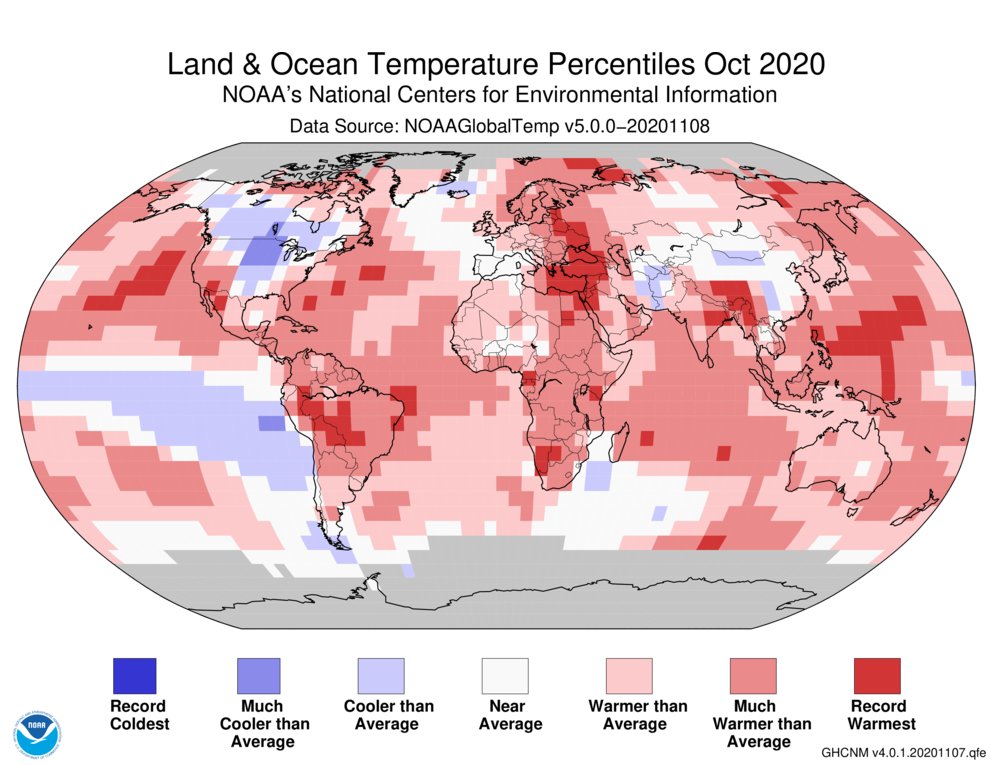
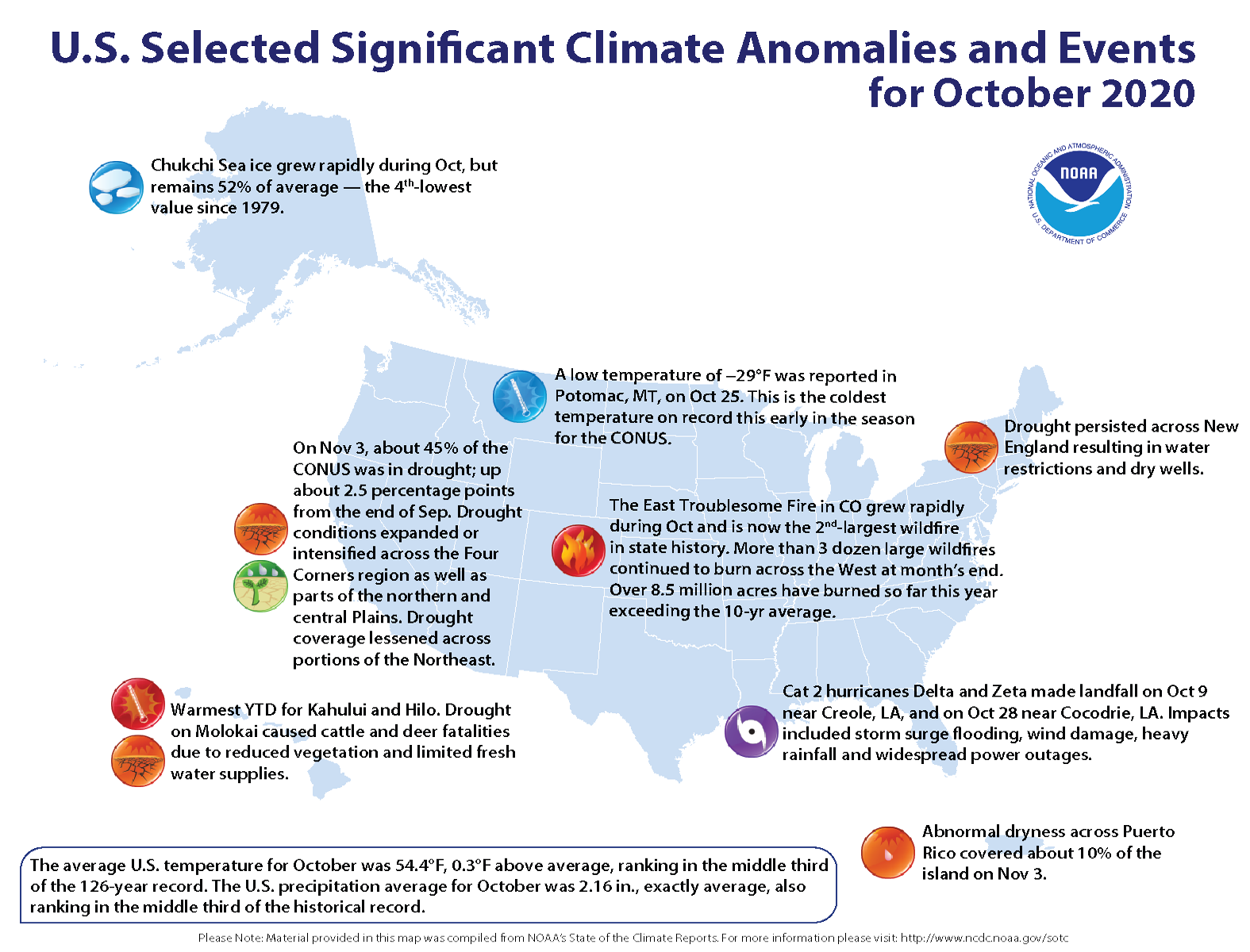
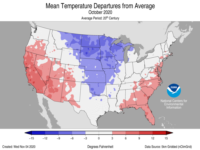
Like most of 2020, NOAA reports that Oct. temps. were a little above avg. - 0.3 degrees F - across the U.S. despite a top 10 coldest Oct. for parts of the Midwest & Northern Plains. This was somewhat offset by a very warm Oct. for Florida (Jacksonville was +4.2 degrees F), Arizona & California. Globally - Oct. was the 4th warmest (+1.53 degrees F) in what will end up being one of the warmest years on record (2nd place so far).

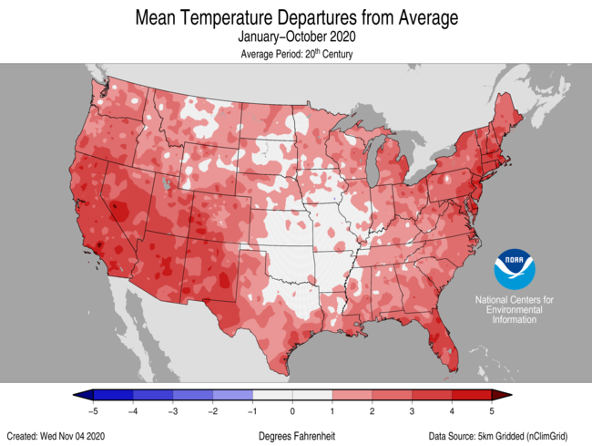
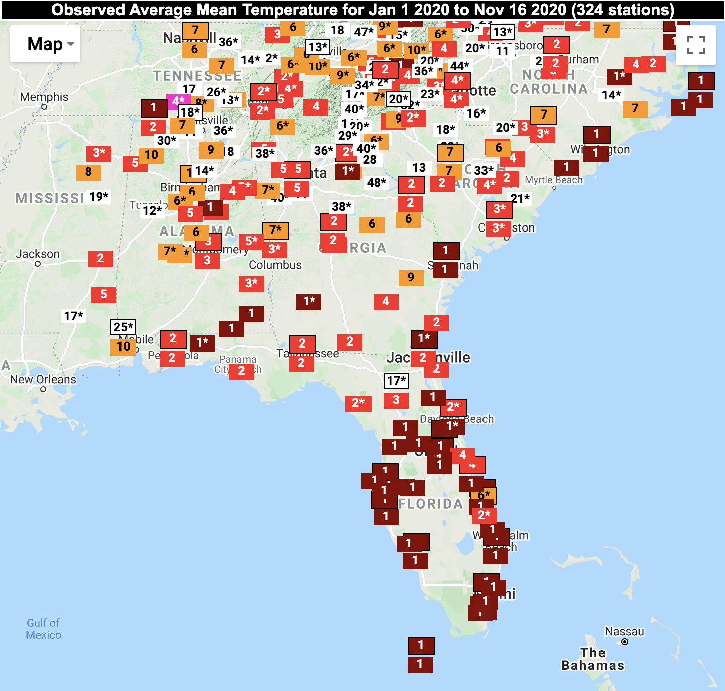
This year so far has been very warm across the Southeast third or so of the U.S. & especially so for the eastern seaboard & Southeast where a number of cities are having their warmest year on record. Jacksonville is in 2nd place for the warmest year on record so far:
Our winters - locally & nationally - have been especially mild recently. The avg. temp. for Jacksonville is up 2.9 degrees since 1970 & as mentioned in the “Buresh Blog” last week - click * here *, Jacksonville has been way below avg. on winter freezes since the winter of 2010-11.


Cox Media Group


 Sign Up


