
Jacksonville, FL — We’re in the final two months of the hurricane season. For the latest: “Talking the Tropics With Mike” - updated every day during the hurricane season.
So our wet season - June through Sept. - is winding down & ended up more than a half foot above avg. officially at JIA. Some places were even wetter. It’s good news heading into our drier winter months & a potentially dry spring (La Nina - see mid Sept. “Buresh Blog”).

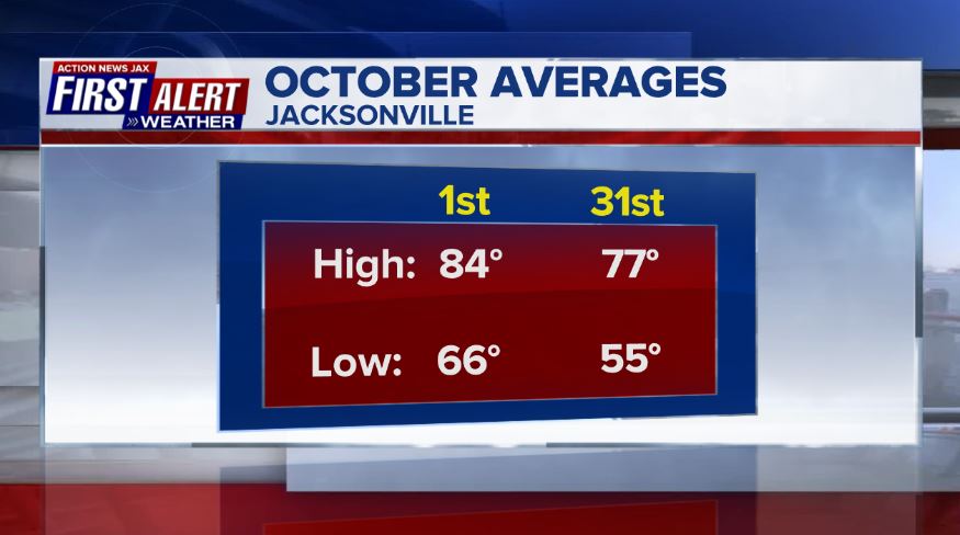
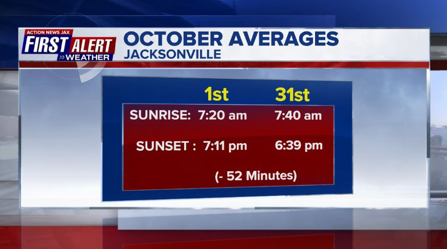
And so it’s on to “true fall” as we move through Oct. Averages for the month at JIA:

Speaking of autumn.... it’s leaf peeping time. Peak color for Jacksonville/NE Fl. typically is not until mid Dec. But a relatively short drive north will be potentially full of color in the coming weeks.

You might often hear meteorologists refer to forecast models including the European Centre for Medium-Range Forecasts (ECMWF). For our local area of NE Fl./SE Ga., the European model is especially important for forecasting the tropics (although it’s had a somewhat rough hurricane season this year). For many years, the model has not been available to the public & was very expensive for the private sector. The story is * here *. American forecast model data has been readily available for many years & especially accessible online. Often times the most accurate forecast ends up being a compromise between two or even several forecast models.
Cox Media Group


