Jacksonville, Fl. — The “Buresh Bottom Line”: Always be prepared!.....First Alert Hurricane Survival Guide... City of Jacksonville Preparedness Guide... Georgia Hurricane Guide.
STAY INFORMED: Get the * FREE * First Alert Weather app
FREE NEWS UPDATES, ALERTS: Action News Jax app for Apple | For Android
WATCH “Talking & Tracking the Tropics: The Science Behind the Season”
WATCH “Preparing for the Storm”
READ the First Alert Hurricane Center “Survival Guide”
LOCAL - Jacksonville/NE Fl./SE Ga. impacts from “Cristobal”:
*** Virtually None - not directly ***
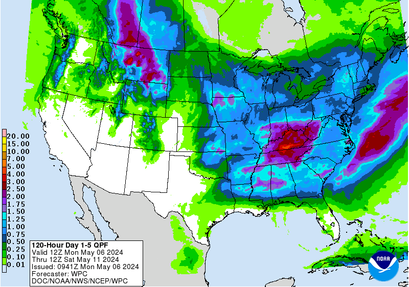
There will be tropical moisture “swinging” northward on the far eastern periphery of of Cristobal leading to heavy rain at times. Rainfall will average 2-5″ across the area with even a few half foot plus amounts. Winds out of the SE will increase some through the weekend leading to heightened rip current risk at area beaches.
BUT... true/direct impacts from Cristobal will occur to the west. If traveling west on I-10 along the Gulf Coast from the Fl. Panhandle to Pensacola to New Orleans to the upper Texas Coast, stay up to date on the latest forecasts & be prepared for tropical storm conditions into Monday. A tropical storm WARNING & storm surge WARNING have been posted from the Fl./Alabama border west through Central Louisiana. Storm surge will even be evident along the west coast of Fl. & the Panhandle due to the large, lopsided (heavily weighted to the east) circulation of Cristobal.
A strengthening Cristobal moved onshore of the state of Campeche in Mexico Wed. morning with winds near 60 mph. A very slow drift over Mexico caused weakening though the tropical cyclone maintained enough organization to fairly quickly regain tropical storm status. Building high pressure near the Bahamas stretching south to the Northern Caribbean has helped with the northward turn now with a landfall west of New Orleans late Sunday/Sunday night.
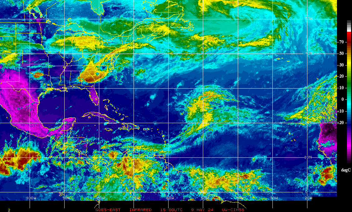
While the circulation envelope of Cristobal is strong, the western & SW side of Cristobal’s circulation is void of much convection due to a great deal of dry air & shear out of the W/SW. This dry air + shear should limit overall intensification or at least make the process of strengthening quite slow. There have been some attempts at banding developing around the circulation center Sunday morning.
So a tropical storm will impact the upper Texas coast & Louisiana Sunday-Monday. It looks like Louisiana will be the “target zone” into Monday. There will be an expanding wind field - especially to the east of the center so some wind, storm surge & heavy rain impacts will stretch as far east as the Fl. Panhandle. Heavy rain/flooding/an isolated tornado threat will then continue north with the remnants all the way into the mid Mississippi Valley.
There continues to be no direct threat to NE Fl./Jacksonville/SE Ga. There is a strong surge of tropical moisture well to the east of Cristobal for Jacksonville & surrounding areas leading to an uptick in t’storm activity & heavy rainfall but mostly independent of the direct center of Cristobal. Rainfall amounts will reach 3″+ through Monday for parts of NE Fl./SE Ga.


There are no other areas of concern right now across the Atlantic. Low pressure will develop this upcoming week over the Central Atlantic where some subtropical development will be possible in area east of Bermuda.
Another area to watch over the next 10 days or so might be the Caribbean &/or Gulf of Mexico yet again.


:quality(70)/cloudfront-us-east-1.images.arcpublishing.com/cmg/WW5AJL3ARQUGDQMAQUNSFX4CLE.jpg)


:quality(70)/cloudfront-us-east-1.images.arcpublishing.com/cmg/HJ3L3HBBJBH6PB5ZFB3SVGFXSU.png)
:quality(70)/cloudfront-us-east-1.images.arcpublishing.com/cmg/4TQDXERT5VGORNZ4NQWXNO5H64.png)
:quality(70)/cloudfront-us-east-1.images.arcpublishing.com/cmg/SKX4RKW645ERTATCLA4V2FVRKQ.png)
:quality(70)/cloudfront-us-east-1.images.arcpublishing.com/cmg/5PIZRG7NYBAHDDABTG5BNVGO6Y.jpg)
:quality(70)/cloudfront-us-east-1.images.arcpublishing.com/cmg/V7JDMMD6JJEEHIL6C7OSLV3ABU.png)
:quality(70)/cloudfront-us-east-1.images.arcpublishing.com/cmg/J4UB75NRRDOML5ZMUZI7QJDELI.jpg)
:quality(70)/cloudfront-us-east-1.images.arcpublishing.com/cmg/W4FYR7IDFLLTCJFDSEAWGKJ7OE.jpg)
