
Jacksonville, FL — This week marks tens years since Tropical Storm Fay dropped record rains on parts of Florida, and waterlogged much of NE Florida.
The National Weather Service says Fay dumped over 20 inches in portions of East Central Florida before slowly moving northward on August 20, 2008.
Fay slowly began a turn to the northwest and made a third landfall near Daytona on August 21st.
Ultimately the storm made four landfalls in Florida, leading to major and record flooding along some rivers in the Florida Big Bend.
INDEPTH: Action News Jax Chief Meteorologist Mike Buresh tracks the tropics every day
A lot has changed since 2008 in the forecasting of tropical events in the Atlantic Basin. The National Oceanic and Atmospheric Administration says the ability to forecast the location and strength of a landfalling hurricane is based on a variety of factors, details that present themselves days, not months, ahead of the storm.
HURRICANE GUIDE: Flood zones, evacuation routes, tips to prepare your home
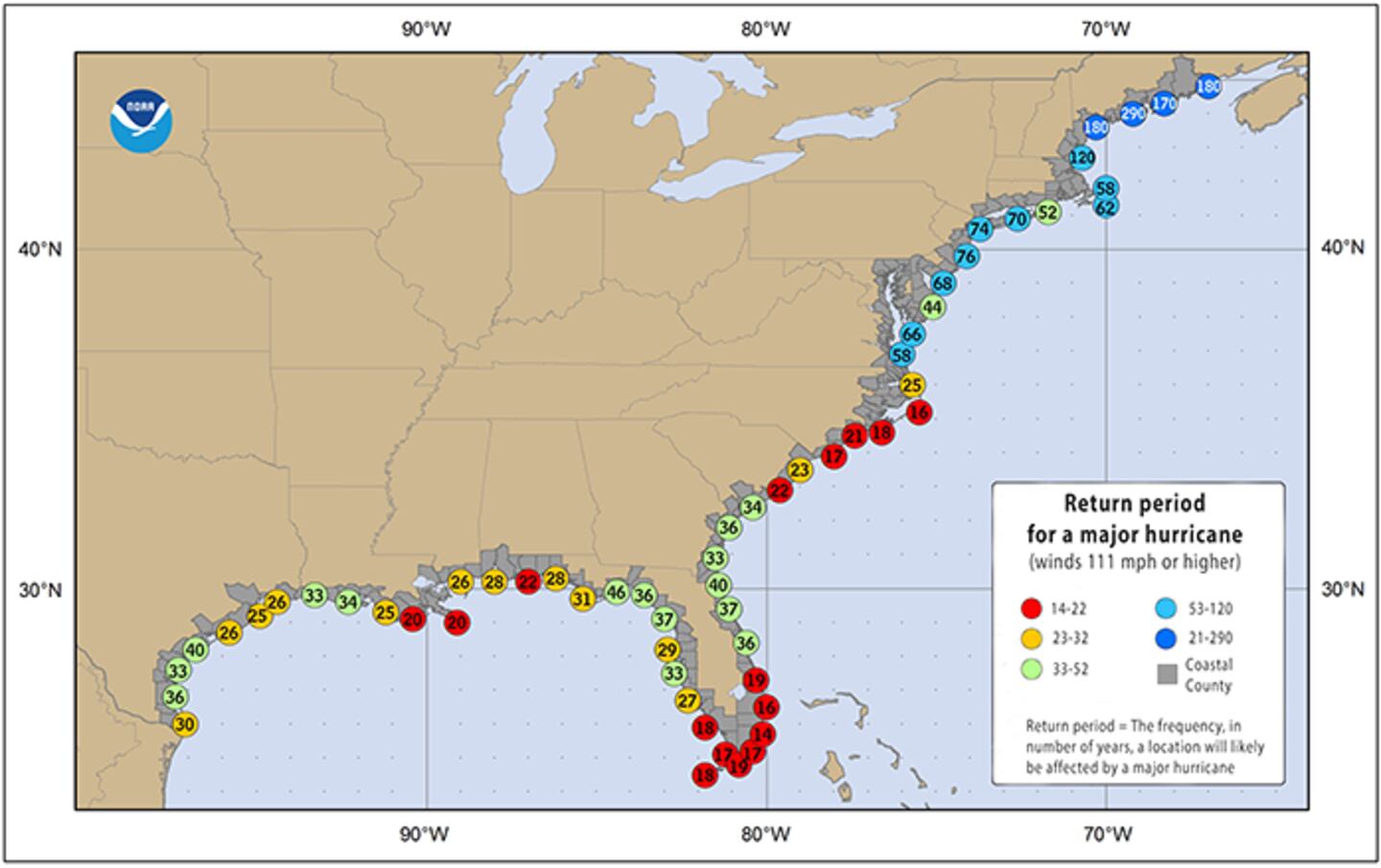
NOAA has outlined the locations that have higher odds of being hit by a tropical storm or hurricane any given year. It uses an analysis tool that quantifies those chances called the hurricane return period.
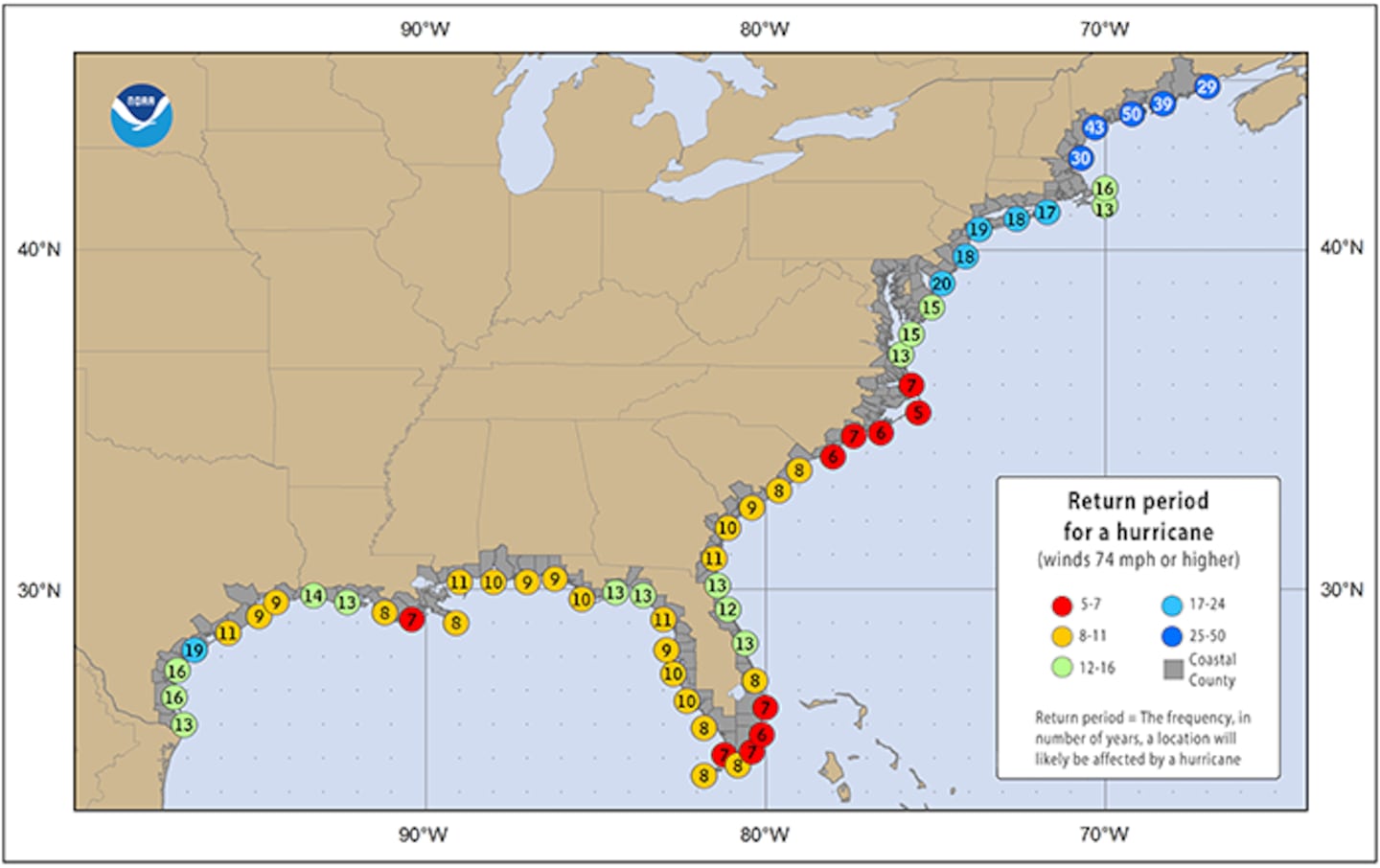
For NE Florida, the return period for a hurricane as 13 years. The return period for a major hurricane is approximately 40 years.
Action News Jax Chief Meteorologist Mike Buresh consistently preaches one message: Always be prepared for an emergency.


